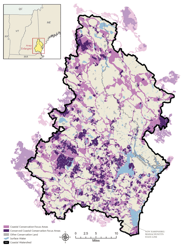
The 2021 New Hampshire’s Coastal Watershed Conservation Plan (Plan) is a science-based, regional conservation master plan that identifies 265,368 acres of CFAs in the Piscataqua Region Watershed across New Hampshire, Maine, and Massachusetts.17 These CFAs encompass conservation priorities for maintaining ecological function and integrity for wildlife and habitat, coastal water resource protection, coastal resilience, and climate adaptation. The Plan identified CFAs by synthesizing and weighting previous conservation datasets used to prioritize land conservation and protect the specific benefits and values mentioned.18-23 The CFAs in the new Plan integrate, update, and replace the 166,212 acres of CFAs identified in The Land Conservation Plan for New Hampshire’s Coastal Watersheds (2006)24 and The Land Conservation Plan for Maine’s Piscataqua Region Watersheds (2010)25 and used for the 2018 State of Our Estuaries report.
Of the 265,368 acres that fall within designated CFAs, 29.3% (77,629 acres) has been permanently protected (Figure 6.1), representing progress toward the PREP goal of conserving 75% of total CFA acres in the region (199,026 acres) but still falling far short. As there have been incremental updates but no substantial, comprehensive updates to the conservation lands datasets since 2017, conserved acres may be underrepresented in the data after this point. Nonetheless, the data we have suggests the need for continued, focused efforts in protecting valuable lands in our region to meet our goal.
Acknowledgments and Credit
Trevor Mattera (PREP), with contributions from Anna Ormiston and Peter Steckler (TNC) and David Justice and Chris Phaneuf (NH GRANIT, Earth Systems Research Center). Graphics from Anna Ormiston and Peter Steckler.
